Mission
Serving Clemson Surveying Clemson enables Clemson students, faculty, and staff who are conducting geospatial research to collect highly accurate field data using state-of-the-art GPS technology.
Available Equipment
Click on the buttons below to see more about the available equipment!
Contact gingric@clemson.edu for more information about this program.
GPS Equipment
Serving Clemson Surveying Clemson offers several GPS units that you can choose from, based on the needs of your research. Find out more about each GPS and compare their specifications below.
EOS Arrow Gold

EOS Arrow 100

Emlid Reach RS+


GPS Accessories
Alongside the GPS units provided by this program, we offer all the accessories needed to get you set up for survey-grade fieldwork!
Samsung SM-T350 Field Tablet
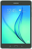
Two Samsung Field Tablets can be checked out with the GPS units. Each tablet is set up with Emlid Flow for the Emlid Reach RS+ and Survey123 for use with any of the GPS units.
The Field Tablets come in protective cases for rugged fieldwork!
Survey Pole

Each GPS receiver is checked out with a two-meter survey pole, keeping the GPS at a constant elevation and making it easy to collect high-accuracy data.
Stabilizing Bipod for Survey Pole

The Emlid Reach RS+ is checked out with the stabilizing bipod in addition to the two-meter survey pole. It attaches to the pole and allows the GPS setup to stand upright without support, letting the unit serve as a base station while you collect other data!
Laser Rangefinders
Serving Clemson Surveying Clemson will soon give access to laser rangefinders, for surveying objects or locations that are difficult to reach. This is handy for surveying in places with poor GPS signal or that are otherwise inaccessible, and for measuring the heights of trees and buildings.
LASER RANGEFINDERS COMING FALL 2025
About the Program
What is Serving Clemson Surveying Clemson?
-
Free access to survey GPS equipment for students, faculty, and staff at Clemson
-
Made available through the Cooper Library Technology Lending Program
What is GPS?
GPS (Global Positioning Systems), also known as GNSS (Global Navigation Satellite Systems), are technologies that use a network of satellites to collect highly accurate location data in the field.
Who is this for?
-
Clemson students, staff, and faculty
-
All majors and backgrounds
-
All skill levels
How much does it cost?
Checking out GPS equipment through Cooper Library is FREE! Take a look here!
Training
Interested students can sign up for the GIS Workshop Series, which includes a workshop on Field Data Collection
Each GPS unit comes with a detailed guide to get you set up and ready to collect data!
Additional Resources
For Emlid Reach RS+
For EOS Arrow Gold and 100

Who Uses Survey-Grade GPS?
GPS surveying is used by a diverse range of industries and fields of study. You've probably seen surveyors at work around the Clemson Campus!
Agriculture and Forestry
Architecture, Civil Engineering, and Construction
Ecology and Environmental Science
Mapping and GIS
Archaeology
City and Regional Planning
History and Geography
And many more!
Made possible by
